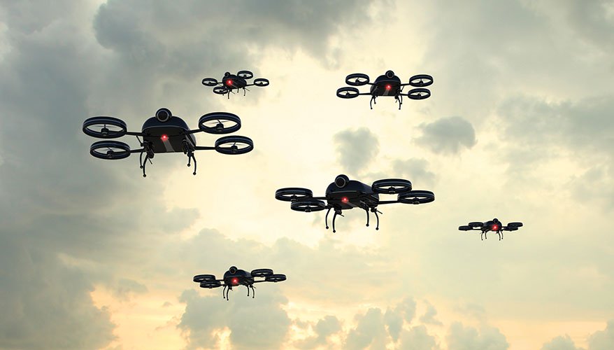
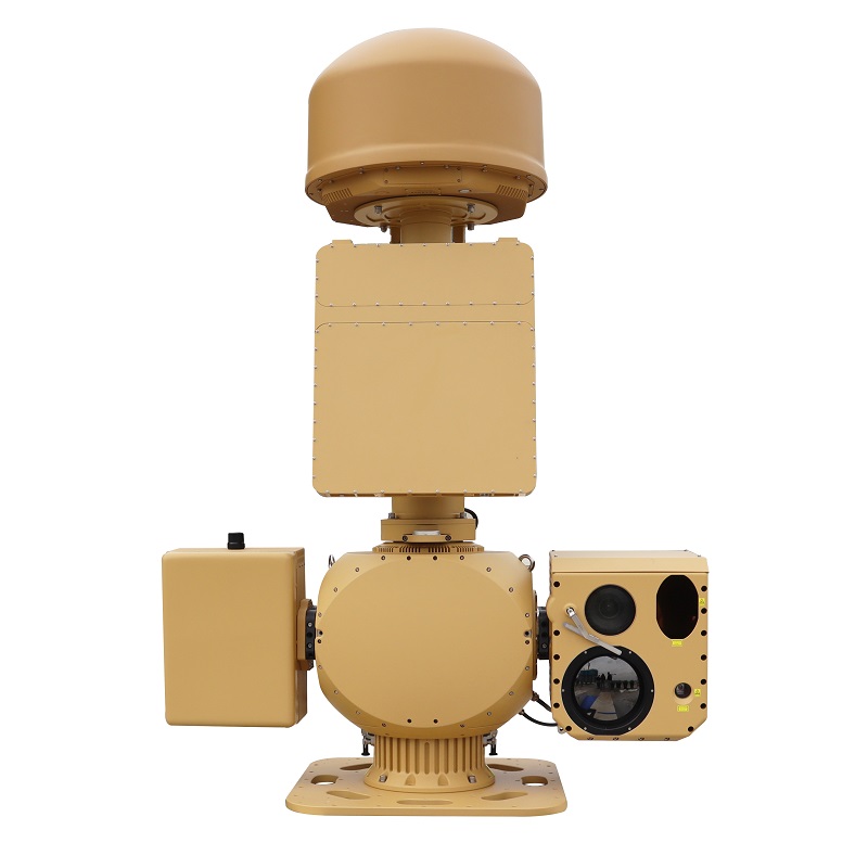
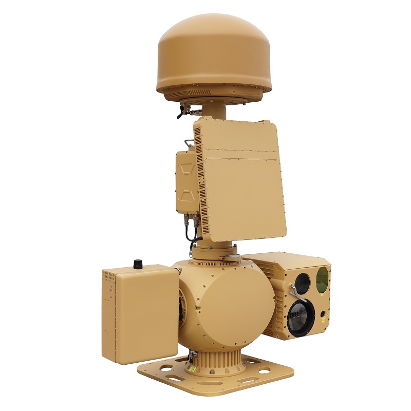
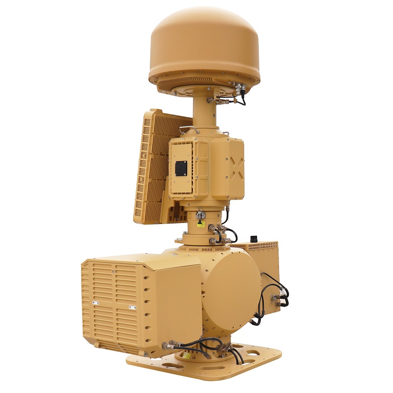
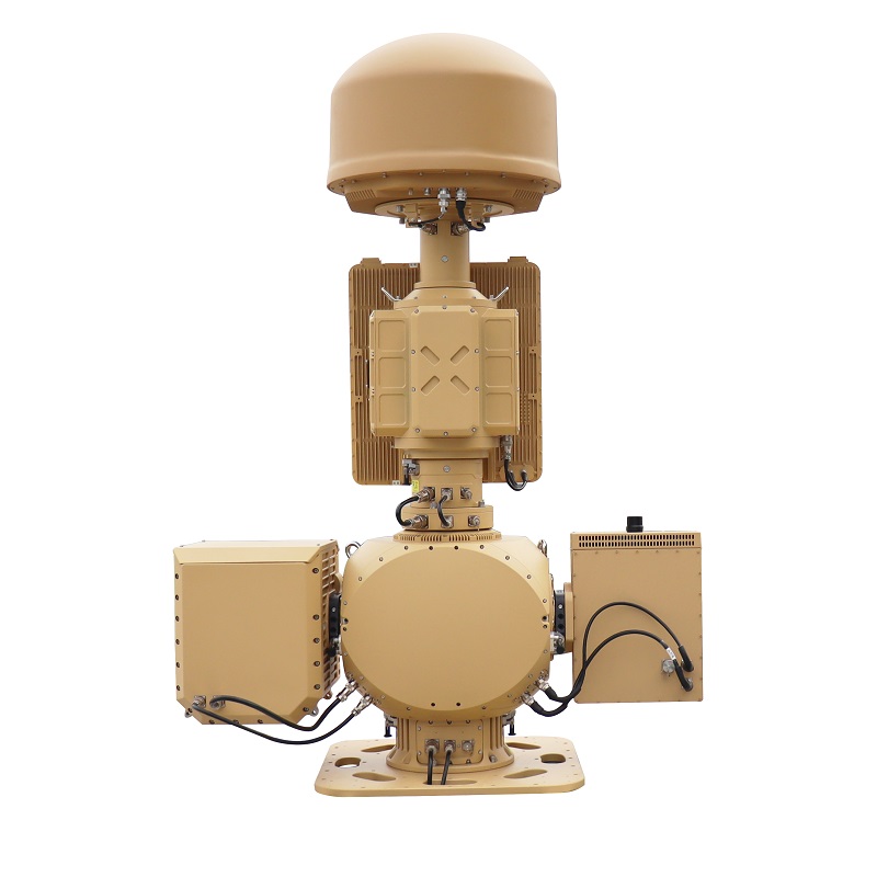
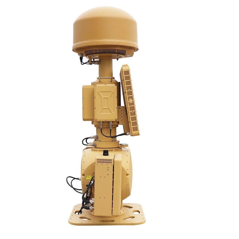
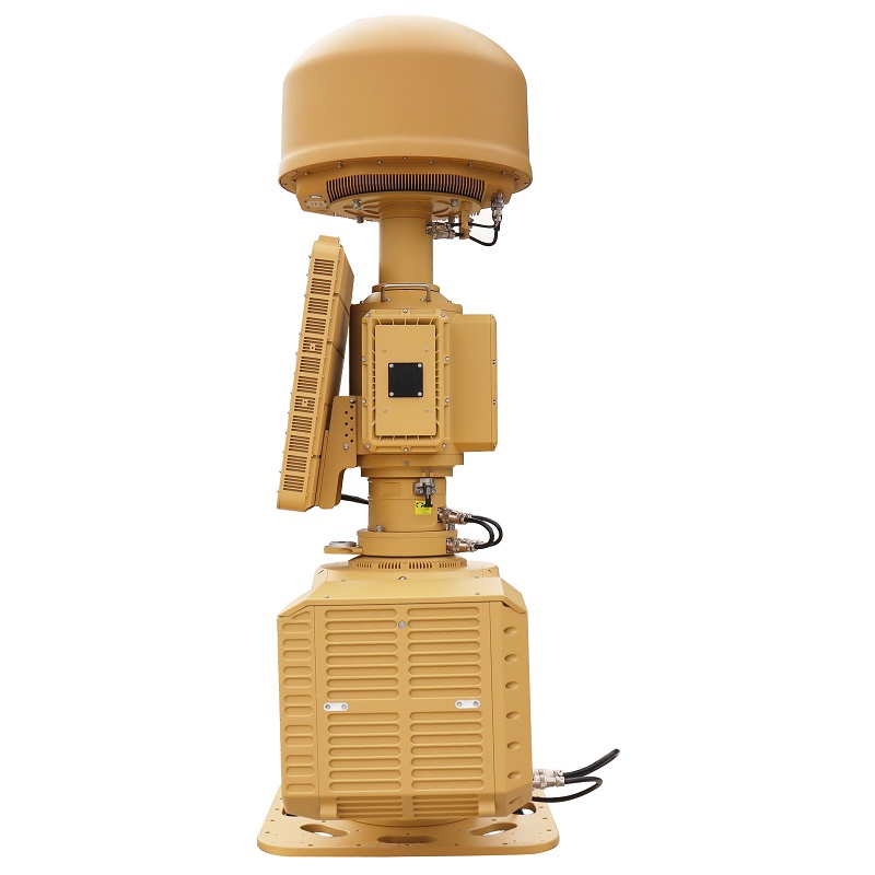
AUS70 Heavy-Duty Integrated C-UAS System
1. Integrated Detection & Identification Combines RF spectrum monitoring, radar surveillance, and EO/IR tracking to enable early detection, verification, and positive identification of unauthorized UAVs.
2. Non-Kinetic Mitigation & Escalation Control Utilizes an integrated RF jammer to disrupt UAV control links, forcing landing or return, with an optional laser dazzler available for controlled escalation based on operational needs.
3. System-Level, Mission-Adaptive Architecture A central AI-managed platform coordinates all subsystems within a compact, modular design, supporting 24/7 operation and mission-specific configuration across diverse security environments.
High Integration & Intelligent Synergy: A fully unified platform where all subsystems operate independently for robust layered defense while enabling seamless, automated handoffs for highly efficient and precise drone neutralization.
Advanced Multi-Mode Spectrum Detection: A versatile RF detection and analysis system capable of both UAV signal detection for early warning and in-depth signal parsing for drone model identification and pilot localization.
High-Performance Radar with Digital Beamforming: Utilizes cutting-edge AESA radar technology with Digital Beam Forming (DBF), providing superior detection range, accuracy, and multi-target tracking capability for low, small, and slow (LSS) aerial threats.
Precision Electro-Optical Tracking: Features high-stability, high-precision servo controls coupled with high-resolution daylight and thermal cameras, guaranteeing stable, continuous, and intuitive visual tracking and confirmation of targets.
Combined Soft & Hard Kill Countermeasures: Integrates RF jamming and spoofing for non-kinetic, reversible effects with an optional laser dazzling module for kinetic hard-kill capability, delivering a complete soft-kill and hard-kill solution.
Fully Modular & Scalable Design: Subsystems are designed for independent deployment or integration. This modularity allows for flexible, cost-effective configurations tailored to specific mission profiles and threat levels.
Rapid Deployment & Low Lifecycle Cost: Engineered for simple installation, wide-area application, and reduced operational complexity. The system minimizes calibration and alignment procedures, featuring one-click operation for rapid mission readiness and simplified maintenance.
The Heavy-Duty Integrated Counter-UAS is primarily deployed for low-altitude airspace security at critical sites and infrastructure, including military bases, airports, prisons, nuclear/chemical/biological industrial facilities, border and coastal defenses, convention centers, government/office buildings, oil fields, and fuel depots.
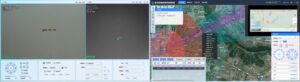
- Multi-rotor & Fixed-wing UAV Identification & Tracking, Eagle-eye View Display
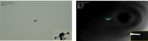
UAV & Remote Controller Signal Detection, Flight Path Detection
 UAV Model Identification
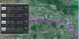
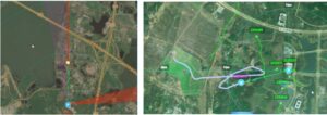
ntegrated Counter-UAS Situation Awareness
| Parameters | Details | |
| Performance & Range | Typical Target: DJI Phantom 4 | |
| • Spectrum Detection & DF Range: ≥ 5 km | ||
| • Radar Detection Range: ≥ 5 km | ||
| • EO Detection Range: ≥ 5 km; Tracking Range: ≥ 4 km | ||
| • Jamming Range: ≥ 5 km; Spoofing Range: ≥ 5 km | ||
| • Laser Dazzling (Optional): ≥ 1 km | ||
| Spectrum Detection | 1. Frequency Range: 300 MHz ~ 6000 MHz | |
| 2. DF Frequencies: 845 MHz, 915 MHz, 1.4 GHz, 2.4 GHz, 3.3 GHz, 5.2 GHz, 5.8 GHz | ||
| 3. Monitoring Bandwidth: ≥ 120 MHz | ||
| 4. DF Accuracy: ≤ 3° (RMS, standard environment) | ||
| 5. Concurrent Target Capacity: ≥ 30 drones | ||
| Radar Detection | 1. Band: X-Band | |
| 2. Refresh Rate: 2 s | ||
| 3. Target Capacity: ≥ 200 tracks | ||
| 4. Minimum Range (Blind Zone): ≤ 50 m | ||
| 5. Coverage: Azimuth: 0°–360°; Elevation: 0°–40°; Altitude: ≥ 800 m | ||
| 6. Accuracy (RMS): Azimuth: ≤ 0.4°; Elevation: ≤ 0.4°; Range: ≤ 5 m | ||
| Neutralization & Spoofing | 1. Jamming Bands: 845 MHz / 915 MHz / 1.4 GHz / 2.4 GHz / 5.2 GHz / 5.8 GHz | |
| 2. Power Amplifier: ≥ 50 W | ||
| 3. Navigation Spoofing Bands: Civil C/A code bands of GPS, GLONASS, BeiDou | ||
| 4. Spoofing Modes: Directed Repelling, Designated Point Guidance, No-Fly Zone | ||
| 5. Coverage: Azimuth: 0°–360°; Elevation: -30° to +60° | ||
| 6. Jamming Mode: Directional | ||
| 7. Capability: Simultaneous link jamming & navigation jamming | ||
| 8. Power Consumption: ≤ 1200 W | ||
| Laser Dazzler (Optional) | 1. Effective Range: 1 km | |
| 2. Wavelength: 532 nm | ||
| 3. Peak Power: ≥ 0.5 MW | ||
| 4. Frequency: 5 Hz | ||
| 5. Beam Divergence: ≤ 8–9 mrad | ||
| Electro-Optical Tracking | Infrared Thermal Imager | 1. Detector: Uncooled Vanadium Oxide (VOx) FPA |
| 2. Resolution: 640 × 512 | ||
| 3. Lens: 23–230 mm, 10x Continuous Optical Zoom | ||
| 4. Lens Control: Motorized Zoom, Manual/Auto Focus | ||
| 5. Image Enhancement: SDE Digital Detail Enhancement | ||
| HD Daylight Camera | 1. Sensor: 1/1.8″ Starlight CMOS, ICR | |
| 2. Resolution: 2688 × 1520 | ||
| 3. Lens: 12.5–775 mm HD Motorized Zoom | ||
| 4. Defog: Optical & Electronic Defogging Support | ||
| Laser Rangefinder | 1. Range: ≥ 3 km (vs. Phantom 4) | |
| 2. Band: 1570 nm | ||
| AI Tracking | 1. Computing Power: Built-in 16 TOPS AI Processor | |
| 2. Method: Front-end Embedded Hardware Recognition & Tracking | ||
| 3. Tracking Modes: Manual, Auto, Radar Cueing Supported | ||
| 4. Recognition: Classifies personnel, vehicles, vessels, drones, etc. (requires customer dataset training) | ||
| Servo Turret | 1. Structure: Side-Loaded, Coaxial | |
| 2. Azimuth Range: N × 360° Continuous Rotation, Mechanical Lock when Powered Off | ||
| 3. Elevation Range: -30° to +60°, Software Limits Configurable | ||
| 4. Speed: Azimuth: 0.01°–100°/s; Elevation: 0.01°–80°/s | ||
| 5. Acceleration: Azimuth: 100°/s²; Elevation: 100°/s² | ||
| Interfaces & Power | 1. Network: 1 × 100/1000 Mbps Ethernet Port | |
| 2. Power Supply: AC 220V ±20%, 50 Hz | ||
| 3. System Power Consumption: ≤ 3000 W | ||
| 4. Dimensions (L × W × H): 1300 mm × 600 mm × 1780 mm | ||
| 5. Weight: ≤ 230 kg | ||
| RGS2000 Low-Altitude Air Defense C2 System | 1. Integrated Design: Command, Control, & Display Platform | |
| 2. Multi-Sensor Integration: Supports connection of detection & neutralization devices | ||
| 3. Situational Awareness: Real-time threat display & distribution | ||
| 4. Data Fusion: Spectrum & Radar track data fusion | ||
| 5. Automation: Supports unattended operation & automatic engagement | ||
- BrochureDownload

Main Products
Our Main Products
At SkyPath we develop cutting-edge drones for every situation. Please browse our products.
Contact Us
Anti-Drone Jammer Seeker
AD SERIES
Anti-jamming antenna AJ410
Anti-jamming antenna AJ440
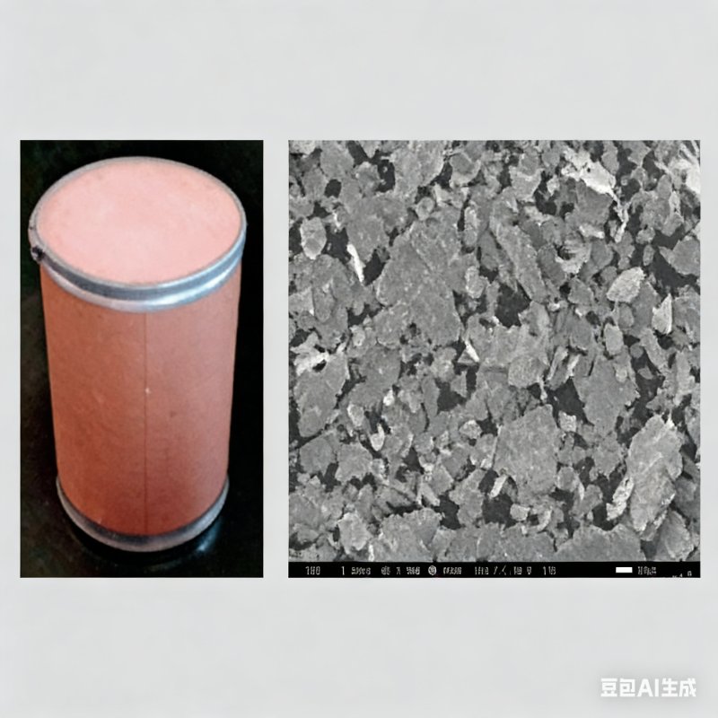
Radar Absorbing Agents

Anti-Drone Capture Net GW10T
News & Announcements
Recent Articles
 13th March 2026
 12th March 2026
 6th March 2026
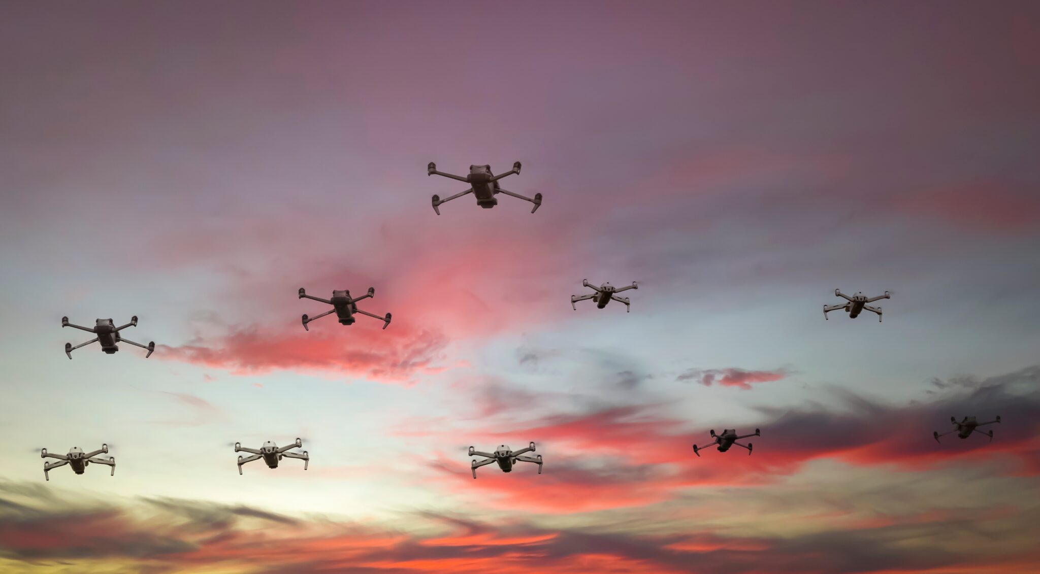 5th March 2026
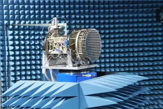 26th February 2026