Product
Product
PHANTOM REAPER X1500
News & Announcements
Recent Articles
 3rd July 2026
The Future of Unmanned Combat Systems: ISR Drones, Autonomy, and Responsible Mission Awareness
Unmanned combat systems are changing how defense, security, emergency response, and public safety teams collect information, assess risk, and respond to fast-moving situations. Drones are no longer limited to basic reconnaissance or simple aerial observation. They are becoming integrated mission platforms supported by sensors, autonomous flight functions, anti-interference technologies, secure communication links, and data workflows. In this future, ISR drones will remain one of the most important categories because they help organizations gain mission awareness before sending personnel into uncertain, remote, or hazardous environments. How Are Unmanned Combat Systems Evolving? Unmanned systems are moving from single-purpose aircraft to system-level platforms. This shift is important because modern users need more than a drone that can fly. They need reliable data, stable navigation, mission payloads, and long-term supplier support. From Reconnaissance to Multi-Mission Support Early military drones were often associated with reconnaissance and surveillance. Their main value was to provide aerial visibility over areas that were difficult or risky for ground teams to reach. Today, unmanned systems can support a wider range of missions. They may be used for border monitoring, infrastructure inspection, disaster assessment, emergency response, security patrol, communication relay, and field awareness. ISR remains especially valuable because it focuses on collecting information, improving decision-making, and reducing unnecessary personnel exposure. From Single Platforms to Integrated Systems A modern unmanned system includes the UAV platform, sensor payloads, ground control station, communication links, navigation modules, data workflow, maintenance support, and operator training. This means buyers should not evaluate a future UAV system only by flight time or range. A reliable system must collect useful information, maintain stable positioning, transmit data securely, and fit the user’s operating environment. From Manual Control to Assisted Autonomy Assisted autonomy will play a larger role in future UAV operations. Route planning, automatic stabilization, sensor-based navigation, AI-assisted perception, and operator decision support can reduce workload and improve mission consistency. However, autonomy should not remove human responsibility. In professional and government-related operations, human oversight, clear approval processes, and lawful deployment remain essential. Why Will ISR Drones Remain Central to Future Operations? ISR drones are likely to remain central because they provide practical value across many environments. They support information collection without requiring teams to enter an area first. How Do ISR Drones Improve Mission Awareness? Mission awareness depends on seeing what is happening, where it is happening, and how conditions are changing. ISR drones can provide aerial views of borders, coastlines, disaster zones, industrial sites, restricted facilities, roads, bridges, and remote terrain. For example, a border team may need to observe a long route between fixed sensors. An emergency response team may need to assess flood damage before sending vehicles. A security team may need to check a facility perimeter after an alert. In these cases, an ISR drone gives decision-makers a mobile aerial viewpoint. Why Is Real-Time Information So Valuable? Many operations depend on current information. If a route is blocked, a structure is damaged, or a security situation is changing, delayed reports may not be enough. ISR drones can collect images, video, location data, and sensor information and send that data to operators or command teams. Real-time or near-real-time information can help teams coordinate faster and reduce uncertainty before committing people or vehicles. How Can ISR Drones Reduce Operational Risk? ISR drones can reduce direct exposure for personnel in hazardous, unstable, or hard-to-access environments. They can inspect routes, structures, wide areas, and restricted zones before ground teams enter. This does not mean drones replace people. Instead, they support human judgment by giving teams better visibility, better documentation, and better preparation. What Technologies Will Shape the Future of Unmanned Systems? Future unmanned systems will be shaped by sensor payloads, AI-assisted data processing, navigation resilience, communication security, and modular design. These technologies will determine whether a UAV is useful in real operating conditions. How Will AI-Assisted Perception Change Drone Operations? ISR missions can generate large amounts of video, imagery, and sensor data. Reviewing all of that manually can be slow and inefficient. AI-assisted perception can help operators identify changes, classify objects, flag anomalies, and organize information faster. The goal is not to replace the operator. The goal is to help the operator focus on the information that matters most. For future unmanned systems, AI will likely become more valuable in data filtering, mission review, and decision support. Why Will Navigation Resilience Matter More? Future UAVs may operate in urban, mountainous, remote, or signal-degraded environments. In these conditions, positioning may be affected by weak satellite signals, blocked signals, or interference. Reliable navigation may combine satellite receivers, inertial measurement units, altimeters, magnetometers, and visual navigation. Vision-inertial navigation is especially important because it can help aerial vehicles maintain position, attitude, velocity, and altitude data when satellite signals are unreliable. For ISR work, navigation quality affects flight safety and data accuracy. If positioning is unstable, the collected information may be harder to use. How Will Communication Links Affect Mission Value? A UAV that captures strong images but cannot transmit them reliably may not meet mission needs. Communication links affect command control, live video, telemetry, and data transfer. Professional buyers should evaluate signal stability, transmission range, encryption, interference resistance, and compatibility with ground systems. In some missions, recorded data may be enough. In others, live video transmission is essential because decisions must be made while the drone is still in the air. Why Will Modular Payloads Become More Important? Different missions require different sensors. A border monitoring project may need long-range visual observation. A disaster response mission may need thermal imaging. An infrastructure inspection task may need stabilized video and mapping data. Modular payload design allows one UAV platform family to support multiple mission types. Common payloads may include EO cameras, IR or thermal sensors, stabilized gimbals, mapping sensors, communication modules, and navigation units. This flexibility can improve long-term value for buyers. How Will Electronic Resilience Influence Future UAV Missions? Future unmanned systems will depend heavily on reliable navigation and communication. Electronic resilience is important because UAVs may operate in areas where signals are weak, contested, or disrupted. Why Are Anti-Interference Capabilities Important? Signal interference can affect navigation, communication, and mission stability. Professional UAV systems may use multi-antenna GNSS support, inertial backup, secure command links, and anti-interference communication methods to maintain safer operation. For ISR missions, stable positioning and reliable links are essential. Without them, the drone may still fly, but the mission value can drop sharply. How Does Vision-Inertial Navigation Support Satellite-Denied Areas? Vision-inertial navigation combines visual information with onboard sensor data. A system may use a visual navigation unit, IMU, satellite receiver, altimeter, and magnetometer to output position, attitude, velocity, and altitude data. This can support aerial vehicles in satellite-denied or signal-degraded environments. For future ISR drones, this kind of navigation resilience will be important in urban areas, remote regions, and complex terrain. Why Does Electronic Resilience Matter for ISR Data? ISR data is only useful if it can be connected to time, location, and mission context. If navigation is unstable, image data may be harder to interpret. If communication is weak, real-time awareness may be delayed. Future ISR drones should therefore be evaluated as resilient data systems, not only flying cameras. Why Choose Skypath as a Reliable ISR Drone Supplier? Supplier selection matters because future UAV programs require more than hardware. Buyers need system-level support, payload integration, technical communication, and long-term service. What Does Skypath Offer? Skypath is a professional UAV and counter-UAS system supplier serving government, defense, law enforcement, security, and emergency-related users. Its product areas include ISR UAV systems, VTOL reconnaissance drones, gimbal cameras, anti-jamming antennas, vision-inertial navigation, electronic resilience technologies, and system-level UAV solutions. Skypath’s solutions are designed around professional mission needs, including ISR operations, airspace security, restricted-area enforcement, and public safety missions. How Can Skypath Support ISR Drone Buyers? Skypath can help buyers match UAV platforms with mission environments, payload needs, navigation risks, communication requirements, and deployment conditions. Support may include product selection, sensor integration, navigation and communication solution support, testing, deployment guidance, after-sales service, and spare parts planning. For professional buyers, this system-level approach can be more valuable than choosing an airframe alone. Conclusion The future of unmanned combat systems will be shaped by ISR drones, AI-assisted perception, resilient navigation, secure communication, modular payloads, multi-drone coordination, and responsible human oversight. Among these trends, ISR remains one of the most valuable roles because it supports mission awareness, safer assessment, and better decision-making. Buyers should not evaluate future UAV systems only by range or endurance. They should also consider payloads, data quality, navigation resilience, communication reliability, compliance, maintenance, and supplier support. Organizations planning ISR drone procurement should prepare mission scenarios, operating conditions, payload needs, communication requirements, navigation risks, and support expectations before choosing a supplier. With the right system and the right partner, ISR drones can help teams see more, respond faster, and make better-informed decisions with less unnecessary risk. FAQs What is the future of unmanned combat systems? The future of unmanned combat systems will likely include more autonomy, AI-assisted perception, resilient navigation, modular payloads, multi-drone coordination, and stronger data workflows. ISR drones will remain important because they support safer observation and mission awareness. Why are ISR drones important in future unmanned operations? ISR drones help collect aerial information, monitor changing environments, and support decision-making without immediately exposing personnel to risk. They are useful for border monitoring, infrastructure inspection, disaster response, public safety, and defense-related field awareness. How should buyers choose an ISR drone supplier? Buyers should evaluate platform reliability, payload compatibility, sensor options, navigation resilience, communication stability, system integration capability, training support, maintenance service, spare parts availability, documentation, and compliance support.
Learn More 3rd July 2026
Military ISR Drone Systems Modern Intelligence Operations for Mission Awareness
Modern intelligence is typically gathered in a timely, accurate and flexible manner to support defense, border security, crisis response, critical infrastructure protection and public safety missions. More than just a late report or a static observation post, timely information and aerial visibility, sensors, communications and data all play critical roles in making timely and informed decisions.Military ISR systems are typically integrated into an unmanned aerial vehicle or drone to collect visual information and to monitor a area of interest. This allows others to “look first” at a potential problem rather than sending a person into harm’s way first. What Are Military ISR Drone Systems? Military ISR drone systems are more than just aircraft or sensors mounted on aircraft to take pictures. They are integrated aerial information systems. They gather information, transmit information, organize information and support the review of the information gathered during a mission. What Does ISR Mean in Modern Operations? ISR stands for Intelligence, Surveillance, and Reconnaissance. The term Intelligence refers to the processing of gathered information to create usable knowledge. The term Surveillance refers to observation of a constant, or of repeated nature, such as of areas, routes, facilities, borders or of events. Reconnaissance refers to a more focused task, namely to gather information of a specific location, situation or operational question. A major component of modern missions are the various functions of ISR, which very often are merged into a single platform. Thus a UAS can monitor a large area, record changes in that area, send live video to its operators, and then capture images which can be analyzed at a later time. The value of ISR is not just that one can see more, but rather that with this flow of current field information one can make better decisions than in the past. How Do ISR Drones Fit Into the System? ISR drones act as flexible aerial platforms. They can carry electro-optical cameras, infrared sensors, thermal imaging payloads, stabilized gimbals, mapping sensors, communication modules, and navigation systems. Compared with fixed cameras or ground patrols, drones can move quickly across different terrain and provide a wider field of view. VTOL reconnaissance drones offer the combination of vertical take off and landing with the efficiency of a fixed wing aircraft for area reconnaissance. They are capable of taking off from small areas and can then be flown for long periods of time for surveillance of areas, monitoring of borders, inspection of infrastructure, for assessment of damage done during disasters as well as for security purposes. Why Are ISR Systems More Than Just Drones? A complete ISR drone system consists of the aircraft, payload, ground control station, communication link, navigation, data workflow, maintenance, and training of personnel. A strong airframe is the first and most important part of the solution. For the professional buyer, what does the longest flight time mean? In the end, the drone must collect the data required by the buyer, it must maintain the correct positioning, transmit the data collected to the buyer in a format usable to him/her. Above all, it must function in an optimal manner to support the team’s true workflow/mission. Why Are ISR Drones Important for Modern Intelligence Operations? ISR equipped UAS’s provide vital information to teams without putting individuals in harm’s way. Additionally, the ability to conduct a field assessment in a timely manner is critical. Often teams are deployed to remote locations and are hindered by difficult terrain and adverse weather conditions that would put individuals at risk were they to conduct an assessment on foot. How Do ISR Drones Improve Situational Awareness? Situational awareness is defined as having knowledge of what is happening, where it is happening, and changes to the situation over time. ISR drones provide aerial views of borders, coastlines, roads, power lines, pipelines, ports, disaster scenarios, restricted sites and remote areas. A border security organization with a long corridor between two fixed sensors would benefit from being able to check the corridor for persons or objects of interest. A disaster response organization would benefit from being able to assess a flooded road before dispatching vehicles. A security organization would benefit from having a greater field of view of a facility’s perimeter. An ISR drone provides a mobile aerial view or vantage point that fixed sensors are unable to provide. Why Is Real-Time Data Important? ISR information is often required in current form rather than in the form of outdated reports, such as: A route is blocked, a structure has been damaged or is changing quickly. ISR drones are able to send live video and images as well as location information and sensor data to the operators or the command team. Real-time or near real-time data can help facilitate coordination with field teams, supervisors, first responders, and security teams. It can also help alleviate uncertainty prior to sending a team and associated resources to a site. What Risks Can ISR Drones Help Reduce? ISR drones can reduce direct personnel exposure in hazardous zones, rough terrain, unstable structures, and remote areas. They can also reduce unnecessary patrol time by helping teams check locations before sending people. Drone data does not have to be interpreted by a drone. In fact, the greatest value of drones to human teams is better visibility, stronger documentation, and greater awareness of the field than would otherwise be possible. What Technologies Matter in a Reliable ISR Drone System? ISR Drone Systems require sensors, navigation, communication, autonomy and data processing to function reliably. The buyer should assess these criteria in conjunction with each other, rather than solely on one specification of the drone system. What Sensor Payloads Are Commonly Used? Common ISR payloads include EO cameras for daytime visual observation, IR or thermal sensors for low-light and heat-signature observation, laser rangefinder modules for distance measurement, and stabilized gimbals for smooth image capture. A stabilized gimbal is especially important when the drone is moving, facing wind, or operating over uneven terrain. SKYPATH’s AD Series gimbal camera supports EO/IR/LRF payload configurations, image collection, manual capture, automatic tracking, and manual tracking. Its 2-axis high-stability platform is designed for applications such as inspection, security, search and rescue, firefighting, and law enforcement support. Payloads are selected based upon the mission being conducted. For a mapping mission, it is usually best to shoot image with as much overlap as possible and try to maintain a constant route. For security, it is usually best to provide a stabilized video with low light capability and also provide thermal images when possible. For a rescue mission, it is typical to try to provide a wide search area as soon as possible, but then zoom in on points of interest to provide better detail for inspectors. Why Do Navigation and Anti-Interference Features Matter? ISR drones can be operated in complex environments where satellite signals are weak, are blocked or even are disturbed. Urban canyons, mountainous areas, dense forests, restricted sites and even electromagnetic interference can seriously affect the quality of the navigation system. In order to provide reliable navigation, it can be a combination of satellite position determination, inertial navigation, vision-based navigation, altimeters, compasses and sensor fusion on board. SKYPATH’s Vision-Inertial Navigation Integrated Module consists of a vision-based navigation subsystem, IMU, satellite receiver, barometer, and compass. It is able to provide positioning, attitude, velocity, and altitude information in satellite denied environment. For professional UAV operations, also anti-jamming technology is important. The SKYPATH AJ410 anti-jamming antenna for instance uses CRPA technology in combination with a digital antenna control unit. This setup enables a stable reception of GNSS signals even in jammed, contaminated radio-electric environments. For ISR missions in general the positioning stability is a critical safety aspect, allows for exact flight paths and for the collected data to have the highest possible value. How Important Are Communication Links? A drone that collects strong imagery but cannot transmit data reliably may not meet mission needs. Communication links affect command control, live video quality, data transfer, and operator confidence. Professional ISR buyers need to look at how far the information can be transmitted, how stable the signal will be, what form of encryption is used, how resistant the signal is to interference, what type of antenna is used, and how it will be controlled from the ground. Some missions will only require information that has already been recorded on the aircraft, while others will require live information so that people can make decisions while the aircraft is still airborne. Why Does Data Processing Matter? ISR missions can generate a large amount of video, imagery, and mapping data as well as data from various sensors. If this data is not properly organized, it can overwhelm an operator. AI-enabled perception, object recognition, automated alerts, and enhanced reporting workflows, organized into decision-enabling workflows, can aid in identification of important changes from vast amounts of video footage. The aim is not to gather hours of video. The aim is to gather valuable information and make timely decisions. Why Choose Skypath as a Reliable ISR Drone Supplier? Skypath is a professional UAV and counter-UAS system supplier serving government, defense, law enforcement, security, and emergency-related users. Its product categories include ISR UAV systems, VTOL reconnaissance drones, gimbal cameras, vision-inertial navigation modules, anti-jamming antennas, electronic warfare products, and counter-UAS solutions. What Does Skypath Offer? Skypath is a system level solution provider for the UAV eco-system, supporting the various components such as UAVs, payloads, navigation solutions, sensors with AI-perception, anti-jamming solutions and integration. Skypath’s ISR platforms are mainly VTOL type of UAVs that can take off and land without a runway, providing full autonomous operations, inter-changeable payload configurations and rapid deployment to areas that require intelligence and surveillance in minutes. How Can Skypath Support ISR Drone Buyers? Skypath assists buyers to select the correct UAV for their mission requirements, payload requirements, navigation requirements, communication requirements and environment requirements. Skypath can assist with technical discussions, selecting products, integration planning and testing as well as deploying the system and providing after sales service and spare parts planning. For buyers looking for a reliable ISR drone supplier a system-orientated approach is far more important than choosing an airframe. Conclusion Military ISR drone systems today form the core of modern intelligence, gathering and processing information in a faster, safer manner and thereby granting mission participants a greater degree of awareness. A reliable ISR solution comprises more than just a flying camera. It also includes the aircraft, sensors, navigation, communication, data processing, training, maintenance and suppliers. When an organization is considering ISR drone procurement, the best place to start is with the mission that the organization is trying to complete. By evaluating the operating environment, the route that will be flown, the type of payload that is required to gather the information needed to complete the mission, the communication range of the platform, the level of navigation risk associated with the flight, the degree to which the platform must comply with various regulations, and the type of support that the organization requires, buyers can determine which platform and supplier is best to support their objectives. With the right platform and the right supplier, an organization can allow its teams to see more, respond faster, and make better decisions with less risk. FAQs What is a military ISR drone system? A military ISR drone system consists of a platform and sensors for intelligence, surveillance and reconnaissance as well as communication, navigation, ground control and data management, etc.. What sensors are useful for ISR drones? Common ISR drone sensors include EO cameras, thermal or infrared cameras, stabilized gimbals, laser rangefinder modules, mapping sensors, and navigation modules. The best sensor package depends on the mission environment, visibility conditions, data needs, and operating range. How should buyers choose an ISR drone supplier? When purchasing a load handling system, the potential buyer must check a number of characteristics of the system, including the reliability of the platform, the possible payload, the resilience of the navigation system, the stability of the communication system, the system integration capabilities, the quality of the operator training, the maintenance service offered, the availability of spare parts, the documentation, and the support offered for compliance with laws and regulations.
Learn More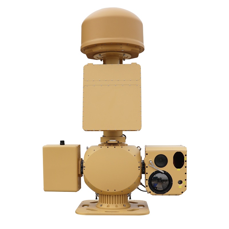 26th June 2026
Understanding Drone Defense How Counter UAS Systems Shape Modern Security
Unmanned aerial systems (UAS) have rapidly evolved and are now a core component of daily life. While innovations in UAS have led to the emergence of new industries in areas such as the logistics, surveillance, and agricultural sectors, the increasing proliferation of UAS has given rise to new security vulnerabilities. As UAS continue to be used by both individuals and organizations, counter UAS (C-UAS) technologies are being employed to counter threats posed by rogue or hostile aerial vehicles. In this article we will look at the ways in which anti-drone solutions are revolutionizing the nature of security today and present a technical, operational, and strategic overview of the solutions currently employed. What Challenges Do Drones Pose to Modern Security? Unmanned aerial vehicles (UAVs) have recently experienced significant growth, as their functionality and affordability have greatly increased. Many of these so-called “drones” pose novel challenges to civil and military security. As they are extremely difficult to detect and can easily penetrate and counter current air and missile defense systems, novel methods for their counteraction are required. Emerging Threats from Unmanned Aerial Systems A serious problem concerns the unauthorized surveillance by means of cameras or signal interceptors of high resolution quality installed on drones over sensitive infrastructure and data. Also equipped with weapons, these drones can conduct explosive or chemical attacks in war zones as well as in public places worldwide. The smuggling of contraband by means of drones, to be brought into prisons as well as across borders, is increasing at a rapid pace. They are impossible to detect by the conventional methods of inspection used by enforcement agencies and require new monitoring methods. The Complexity of Detection and Identification Detecting these threats is inherently difficult due to the small size and low radar cross-section of modern UAVs. Differentiating between friendly commercial drones and potentially hostile ones requires advanced analytics capable of interpreting flight patterns, signal signatures, and operational behaviors. Urban environments compound this issue—dense structures cause signal reflections and interference that obscure radar or radio frequency readings, complicating identification efforts for security teams. How Do Counter UAS Systems Operate? Innovation in designing and fielding Counter UAS (C-UAS) systems is evolving to tackle these UAS-related challenges using a layered Defense approach to detect, track, identify and mitigate UAS threats and protect people, information, assets, facilities, and geospatial airspace from emerging UAS threats, to detect and deter or disable or destroy and remove the UAS from the National Airspace System to prevent negative impact and/or to conduct maliciously-directed harm. Core Components of a Counter UAS Framework Detection relies on multiple sensor types such as radar arrays, radio frequency (RF) analyzers, acoustic sensors, and electro-optical/infrared (EO/IR) systems to locate drones across various ranges and conditions. Tracking provides continuous monitoring for situational awareness, enabling operators to evaluate threat levels dynamically. Identification employs artificial intelligence-driven classification algorithms that determine drone models, control frequencies, and potential intent based on behavioral data. Finally, Mitigation encompasses both non-kinetic and kinetic responses—ranging from jamming communication links or spoofing GPS signals to deploying interceptors or directed-energy devices designed to neutralize drones safely. Integration with Broader Security Networks Modern C-UAS systems are designed to operate in a transparent manner to integrate into centralized command and control centers in order to provide a coordinated response to emerging situations. The key to a successful system is data integration in order to provide real-time information to all parts of the system in order to allow different nodes in the system to provide appropriate information to support the network as a whole. Interoperability across all levels, from local event or airport use to national wide protection of critical infrastructure, is a scalability aspect of C-UAS systems. Why Are Counter UAS Technologies Crucial for Critical Infrastructure Protection? Intrusions by drones into critical infrastructure such as energy and industrial facilities, transportation systems, and government facilities pose increasing threats to operational continuity and to safety of people. The Role of C-UAS in Safeguarding Strategic Assets Counter-UAS solutions are used to prevent unwanted surveillance flights over restricted areas and to prevent malicious attempts to sabotage facilities by means of explosive payloads as well as by electromagnetic interference. C-UAS systems also ensure business as usual by stabilizing secure airspace around critical installations. Even minor disruptions to such sites can have severe economic or safety effects. Regulatory and Operational Considerations Legal compliance is fundamental when deploying anti-drone measures; adherence to aviation authority regulations such as those set by the FAA or EASA ensures lawful operation within civilian environments. Balancing robust security with privacy protection remains an ongoing policy challenge requiring transparent governance frameworks. Continuous operator training further strengthens system effectiveness under evolving threat conditions. How Is Technology Advancing the Effectiveness of Anti-Drone Solutions? Advances in technology are enabling rapid developments in defenses against drones through automation, AI, sensor fusion and adaptive systems. Artificial Intelligence and Machine Learning Applications AI enhances target recognition accuracy by analyzing flight behavior patterns in real time. Machine learning enables faster adaptation against swarming attacks or autonomous UAVs by drawing on historical engagement data for predictive modeling. These intelligent algorithms continuously refine decision-making processes across detection-to-mitigation workflows. The Role of Sensor Fusion in Threat Detection Sensor fusion from radar, RF sensors, EO/IR cameras and acoustic arrays enables unified situational awareness within one interface. By correlating multiple sensors, Sensor Fusion minimizes false alerts from environmental noise significantly. It also increases range accuracy and the time to alert. In high risk areas like airports or military sites, this can translate into precious time to respond correctly as false alerts in these scenarios can result in a fatal delay in the execution of a response. Who Are the Key Players in the Counter UAS Market? The global demand for anti-drone technologies has pushed established defense companies and new, specialized technology start-ups to develop and market reliable systems, many of which are designed to be easily upgradeable and to be configured as modular countermeasures. Overview of Industry Leaders and Innovators Established defense integrators continue to run large-scale deployments of hybrid systems, with robust hardware underpinned by sophisticated software intelligence. Other technology companies are building modular systems for use in a non-defense environment – event security, industrial site protection etc. A variety of startups are also building innovative new solutions including AI based detection and portable mitigation systems optimized for rapid deployment. Skypath: A Trusted Supplier in Counter UAS Solutions The AUS70 is a heavy-duty, fully integrated Counter-UAS (C-UAS) system providing automated, all-weather protection against unauthorized low, slow, and small (LSS) UAV threats. Integrated Detection & Identification Combines RF spectrum monitoring, radar surveillance, and EO/IR tracking to enable early detection, verification, and positive identification of unauthorized UAVs. Non-Kinetic Mitigation & Escalation Control Utilizes an integrated RF jammer to disrupt UAV control links, forcing landing or return, with an optional laser dazzler available for controlled escalation based on operational needs. A central AI-managed platform coordinates all subsystems within a compact, modular design supporting 24/7 operation across diverse security environments. Skypath’s AUS70 exemplifies advanced drone defense integration through its High Integration & Intelligent Synergy, ensuring seamless subsystem coordination for efficient neutralization workflows. Its Advanced Multi-Mode Spectrum Detection enables precise UAV model identification and pilot localization using wideband RF analysis capabilities spanning 300 MHz–6000 MHz frequencies. The High-Performance Radar with Digital Beamforming delivers superior range accuracy up to 5 km while tracking multiple aerial targets simultaneously—ideal for protecting sensitive airspace around airports or industrial facilities. In addition to this, the system’s Combined Soft & Hard Kill Countermeasures offer a comprehensive set of threat engagement options, by enabling the jamming or spoofing of enemy sensors using RF signals, while also offering the option of a laser dazzling module for hard kill applications. The Fully Modular & Scalable Design of the system’s components, also supports installation in a number of different formats, to offer users a flexible solution that can be easily installed and integrated into a border or urban protection regime, without added cost. The Heavy-Duty Integrated Counter-UAS system is a low-altitude airspace security system designed to protect critical sites such as military bases, airports, prisons, nuclear/chemical/biological industrial facilities, border defenses, convention centers, government buildings, oil fields, and fuel depots. How Will Counter UAS Systems Influence Future Security Strategies? As technologies used to counter UAS evolve and are increasingly embedded within larger national defense systems and even commercial protection of air and other space shared by organizations, new opportunities and challenges are emerging. Integration into Multi-Domain Defense Ecosystems Coordinated interoperability between land-based sensors and aerial surveillance networks enhances situational awareness across multiple operational domains—land, sea, air, and cyber. Shared intelligence frameworks accelerate decision-making during potential drone incursions while predictive analytics anticipate emerging threat vectors before they materialize into actionable incidents. Policy Development and Ethical Implications Around the world governments are formalizing rules regarding the interception of drones in order to ensure that any defensive actions are proportionate. The ethics of jamming a drone in a populated area for example, is becoming increasingly important and is leading to the way in which such actions can be conducted in order to minimize disruption whilst protecting people and assets. There is also increasing collaboration between industry and governments to develop standard methods for countering threats to aircraft and developing and implementing harmonized policies and strategies for counter-drone in order to create safe skies. Conclusion Counter UAS systems form part of a more advanced security solution that combines the latest in sensing technology with adaptive AI analysis in order to protect society against ever increasing aerial threats. The use of drones is increasing rapidly in both the military and commercial markets and integrated systems such as Skypath’s AUS70 provide a precision engineered, automated solution that offers the highest level of protection to critical national infrastructure whilst ensuring that all relevant regulations are adhered to along with the rights of individuals. FAQs What distinguishes a counter UAS system from traditional air defense systems? Counter UAS systems are specifically designed to detect, identify, track, and neutralize small unmanned aerial vehicles that conventional radar-based air defenses may overlook due to their size or flight altitude. Can counter-drone measures operate legally in civilian environments? Yes—when deployed under proper authorization and within regulatory frameworks established by aviation authorities such as the FAA or EASA; unauthorized use may violate communication laws due to signal interference. How do organizations choose the right C-UAS solution? When selecting security solutions various operational requirements need to be considered. These include the area that is to be covered, the assessed threats, environmental issues, integrability with existing systems of infrastructure, as well as local regulations prior to a purchase decision being made.
Learn More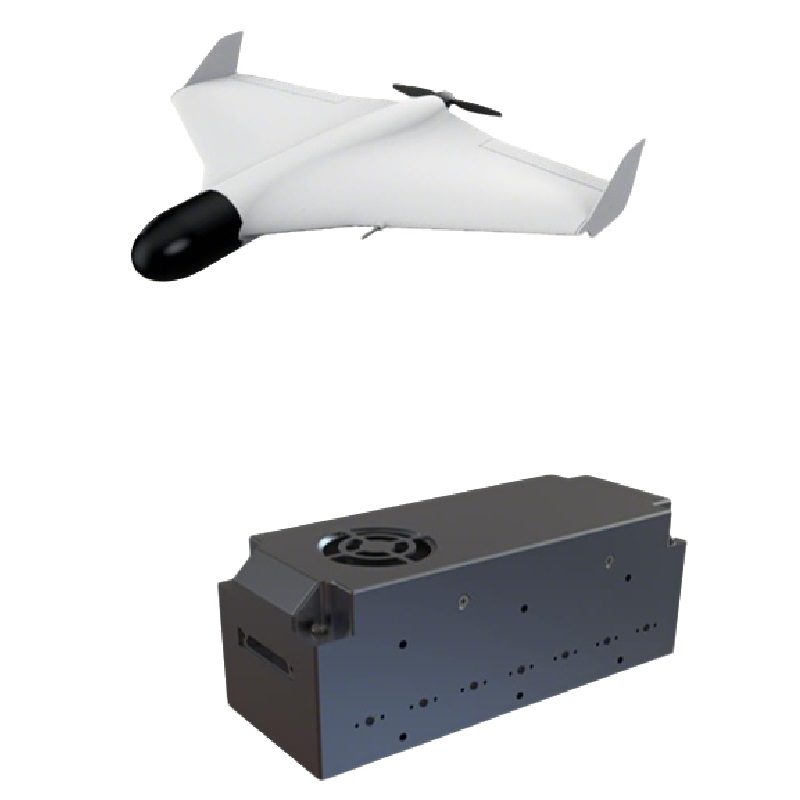 25th June 2026
How Jammer Seeker Enhances Anti-Drone Defense Capabilities in Complex Environments
Unmanned aerial systems (UAS) are rapidly evolving and become more mobile, autonomous, and complex. Consequently, current counter-measures for malicious use of UAS face ever-changing challenges in ever more complex environments. Detection of UAS is no longer the sole sufficient task of defense systems. As operational environments become more and more electromagnetic, crowded with signals and complex in terms of physical structures, defenses are required to maintain effective targeting and suppression of threats in uncertainty, operating in urban security areas, protecting critical infrastructure and in general on the battlefield. New and advanced electronic warfare tools such as the Jammer Seeker are increasingly used in future counter-UAS systems. The Jammer Seeker supports detection and effective engagement of jammed sensors by means of intelligent signal recognition and adaptive jamming coordination. This article describes in detail how the Jammer Seeker can improve detection and jamming and integrate into a larger defense network to safeguard of air and other spaces. What Challenges Do Complex Environments Pose to Anti-Drone Operations? Modern anti-drone operations have a multitude of challenges when it comes to conducting said operations within complex environments such as urban, industrial and military environments. These challenges are primarily hindered by the dense levels of electromagnetic interference found within said environments, along with adverse visual factors such as line of site obstruction and ever-evolving methods employed by drones in order to evade negative effects from anti-drone systems. These evolving methods, combined with the factors of detection, identification and ultimately engagement within said complex environments pose significant challenges to the respective processes of respective counter-UAS systems. Signal Interference and Spectrum Congestion Anti-drone systems in high electromagnetic density environments face many challenges. The environment is saturated with RF signals from sources such as local area network Wi-Fi, cellular communications, and industry equipment. In such a crowded environment, the narrowband signals of drone control and sense links can easily be masked by background noise, allowing them to remain undetected and thereby allowing them to pose a threat for some time. Many UAS use frequencies that are already in use for civilian communications. Counter-UAS sensors and jamming systems can be negatively affected by overlapping frequencies with these civilian communications. In the worst case, this could result in false detection and engagement of a civilian aircraft, or a UAS signal could not be effectively jammed due to civilian signal overflow. Physical Barriers and Terrain Complexity The urban environment, with its many buildings, trees, and even changes in ground level, introduces physical obstacles to line-of-sight detection. The multipath effects that these obstacles introduce to radar signals as well as to RF tracking signals from the drone, cause significant difficulties in tracking the position of the adaptive drone. In particular, the drone can fly very low, even into between buildings, or through very narrow openings, and thus evade traditional jamming or other forms of interception. In order to counter such drones, sensing strategies that are able to penetrate through the environmental masking that is introduced by the physical environment must be incorporated into anti-drone systems. Dynamic Threat Behavior In addition to these methods to counter drones, the dynamic behavior of modern drones to defend against them has to be taken into account. Autonomous flight control systems of drones are able to change their flight path during active countermeasures like jamming or GPS spoofing. In addition, new tactics with so-called drone swarms have to be expected. These swarms consist of several drones that are operated in a cooperative manner. This results in an increased complexity for detection and defense systems. In order to counter drones effectively, defensive measures have to be flexible in order to react in real time to the various application cases. How Does Jammer Seeker Strengthen Detection and Targeting Accuracy? The Jammer Seeker product offers a detection and targeting solution using multi-sensor fusion and intelligent signal processing. The “Drone Hunter” Anti-Drone Jammer Seeker is a small, miniaturized, electronic warfare (EW) payload, which is meant to be mounted on loitering munitions or attack drones. Its mission is to detect, identify and geolocate jamming sources of enemy drones in a very wide frequency range, while keeping a high accuracy in highly cluttered electromagnetic environments. Multi-Sensor Fusion for Reliable Threat Identification Jammer Seeker’s architecture combines radar sensing, RF analysis, optical imaging, and acoustic detection into a unified system that ensures comprehensive situational awareness. By continuously providing precise azimuth (directional) data of the hostile jammer to the drone’s flight control system, it works in tandem with an onboard electro-optical (EO) system for final verification. This cross-verification reduces false alarms common in congested environments. Adaptive algorithms refine detection thresholds based on real-time feedback from environmental conditions such as signal density or atmospheric interference. Direction-Finding Precision in Electromagnetic Clutter Dense RF environments with changing signal levels and significant amounts of interference enable Jammer Seeker to use its high-gain antennas to accurately detect the source of interfering signals. Its advanced filtering enables it to discern and track legitimate communication signals from control signals used by hostile drones or jammer units. It accurately tracks and reports multiple emitters operating within the same general frequency space but within different frequency bands. Real-Time Data Processing and Decision Support Jamming emitters are detected instantly by the computing unit of the system. The emission characteristics of detected emitters or their distance to so-called protected zones are used to automatically classify detected emitters as high risk for defensive action and to prioritize them. Jammer Seeker-equipped systems are connected to the command computer of broader command networks. Thereby, Jammer Seeker-equipped systems are able to immediately share all data that has been acquired on current threats with other defensive system components within seconds in order to initiate appropriate joint response actions in several layers of defense. In What Ways Does Jammer Seeker Improve Jamming Efficiency? Jammer Seeker is not only able to precisely detect targets, it also significantly increases the efficiency of jamming by controlling and adapting the jamming in real time in order to avoid excessive interference and, at the same time, effectively prevent hostile drones from completing their mission. Adaptive Jamming Techniques The output power of Jammer Seeker can be changed based on the distance to the target and the signal power. The frequency can be selectively targeted within a range of frequency bands that correspond to enemy control links and/or telemetry links. Smart learning algorithm from past engagements is used to improve the efficiency and effectiveness of Jamming in subsequent engagements against changing threat. Frequency Agility and Signal Control Frequency agility enables Jammer Seeker to search across multiple frequencies that are used by today’s UAVs that employ frequency-hopping communication and enable the jammer to continue to attack the UAVs when they attempt to use spectrum agility to avoid being attacked. In addition, Jammer Seeker has two modes of operation for its jamming. Directional jamming can be focused on a single target for maximum effectiveness. The omnidirectional mode of operation can be used to attack all targets in a surround scenario where a swarm of UAVs are attacking a single location. Minimizing Collateral Impact on Friendly Systems Safety of operation in mixed electromagnetic environments is a critical task. Since such operations are performed by friendly forces using the same communication infrastructure, operational safety of Jammer Seeker has to be ensured. Jammer Seeker is equipped with safety features to prevent interference with allied communication networks. It can be set up with exclusion zones to protect signals of interest from being jammed. Furthermore, it complies with civilian regulations for operation in areas with a high population density or near critical infrastructure like bridges etc. and needs to preserve spectrum integrity. How Does Jammer Seeker Integrate Into Broader Counter-UAS Architectures? Effective airspace defense requires integration across multiple sensor modalities and engagement layers. The modular design of Jammer Seeker supports seamless incorporation into existing counter-UAS ecosystems comprising radar surveillance units, electro-optical trackers, electronic support measures (ESM), and kinetic interceptors. Networked Operation Within Multi-Layer Defense Systems The Jammer Seeker system interfaces with standard radar systems via interoperable communication protocols. It shares real time information with other distributed assets to enhance situational awareness of the emitter’s location. This information is then contributed to a central command center that manages a layered defense system. Information from the Jammer Seeker can be used to coordinate engagements between the Jammer Seeker’s electronic warfare assets and the interceptors, with the emitter being suppressed by the Jammer Seeker’s assets before being engaged by the interceptors. This strategy optimizes the use of the defense network’s assets. Scalability Across Deployment Scenarios Modular and flexible for fixed, mobile and temporary installations, the system can protect critical infrastructure, convoy routes, bases and facilities. It can be also easily deployed by tactical teams moving from place to place and working in dynamic environments. Scalable in terms of the area to be covered and the number of sites, it can be set up to create local protection areas or even to monitor a wide area. It also allows for a centralized or decentralized command structure, in line with the users’ operational methods and doctrine. Why Is Skypath a Reliable Partner in Counter-UAS Solutions? Skypath is one of the world’s leading technology companies specialized in electronic warfare, anti-drone technologies and related solutions and products that support defense, law enforcement and critical infrastructure entities, focusing on highest technology and highest operational capability, adhering to highest professional standards and service quality. Commitment to Innovation and Quality Assurance The “Drone Hunter” Anti-Drone Jammer Seeker is a small, miniaturized electronic warfare (EW) payload for loitering munitions and attack drones. This is in line with the Skypath miniaturization approach without compromising functionality for achieving robustness in contested environments while at the same time being compliant with international rules for EW systems. Comprehensive Support Ecosystem In addition to Skypath’s range of hardware Skypath also offers a comprehensive range of client support services. Skypath’s Operator Training Sessions, Technical Assistance, Firmware Updates and Life Cycle Maintenance Planning ensure that the Skypath system continues to operate at peak performance throughout its deployment life. Conclusion: The Strategic Value of Jammer Seeker in Modern Defense Networks This system is a cornerstone of advanced drone-centric electronic warfare tactics: It exemplifies how precision sensing combined with adaptive jamming transforms defensive posture against complex aerial threats into proactive suppression capability. By merging autonomous decision-making with multi-sensor intelligence fusion, Jammer Seeker empowers operators to maintain secure airspace dominance even amid dense electromagnetic clutter—reinforcing its strategic importance within next-generation defense architectures focused on integrated counter-UAS operations. FAQs 1. What types of drones can Jammer Seeker detect and neutralize? Jammer Seeker can identify commercial-grade UAVs, modified hobbyist platforms, and custom-built drones operating across various RF bands used for remote control or GPS navigation links. 2. Can Jammer Seeker operate effectively in urban areas with high signal density? Yes. The adaptive filtering algorithms of the system are able to distinguish between legitimate communication traffic and drone-associated signals also in highly populated metropolitan areas. 3. How does Jammer Seeker support multi-system coordination during large-scale operations? Through standardized network interfaces compatible with existing C4ISR infrastructures, it shares real-time target intelligence enabling synchronized responses among surveillance radars, EO trackers, and interceptor units during coordinated defense missions.
Learn More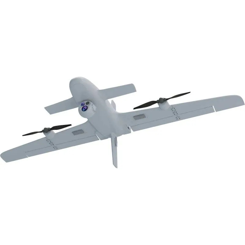 12th June 2026
Fixed Wing Drone: The Complete Guide for Professionals
As fixed wing drones are designed for efficient flight in the forward direction, they are different from multi rotor drones, which spend most of their time airborne simply staying there. The wings of a fixed wing provide the lift to allow flight, and there are many key parameters, including range, endurance, and even payload, that are significantly different from a multi rotor, including the way a drone is launched, the amount of training required to fly it and the type of jobs that it is well suited to. For professional teams it is not a question of whether fixed wing drones are better than multirotors. The question is rather where the fixed wing platform is best to be used. In situations where long distances, large areas, repeated mapping flights, corridors along borders, lines of industrial sites or even reconnaissance/observation are involved where the drone can stay in the air for a long time as opposed to just hovering around one point, a fixed wing platform is the better choice for the mission. What is a fixed wing drone? A fixed wing drone is an unmanned aircraft with wings that remain in a fixed position during flight. It may use an electric motor, hybrid power system, or other propulsion setup, but its main advantage comes from aerodynamic efficiency. Once airborne, it can travel farther with less energy than many hover-only drones. Shadow Striker 2400 page on Skypath’s website shows a VTOL fixed-wing UAV which can take off vertically and then fly efficiently along a route. How is a fixed wing drone different from a multirotor? Multirotors are powerful for things like hovering, tight close up work, vertical flights and easy take off and landing in confined spaces. Fixed wing aircraft are generally powerful for long duration flights and long distance travel. Many professional buyers actually purchase in both categories as each solves different problems. Category Fixed wing drone Multirotor drone Best fit Long routes and wide-area coverage Close inspection and hovering Endurance Usually longer for route flight Usually shorter under hover load Launch need Runway, catapult, hand launch, or VTOL design Vertical takeoff from small spaces Payload style Mapping, surveillance, route observation Close camera work, spot inspection Operator focus Route planning and recovery area Position control and obstacle clearance Why do professionals choose fixed wing drones? The main reason for using a fixed wing drone over multirotors for inspection work is the coverage that they can provide. Unlike multirotors which may manage to complete a satisfactory inspection from a number of takeoffs and landings from individual inspection points – meaning that the work is counted in individual sites to be inspected – a drone with fixed wing flight will fly the entire area of the work required along a planned flight path, covering kilometers of the work as a single flight, and requiring fewer recharges of the battery for the work to be completed. A good example of where this is particularly beneficial is over large areas of farmland or open terrain, where along linear features such as roads, pipelines, powerlines, or coast and border lines, a linear coverage is required. Longer endurance Endurance is typically one of the first considerations when a buyer is looking to make a purchase. Flight time is critical in ensuring that there are fewer launches, less battery swapping and less time spent dealing with interruptions in the field. And, in completion of routes, there is some buffer for items outside of normal operation such as wind and terrain that will add time to completion of a normal route. Better route efficiency Fixed wing aircraft are normally most efficient flying continuously in one direction, hence suited to projects such as mapping grids, corridor surveys, perimeter checks and patrol routes where the most efficient method of survey is flying in a straight line in one direction. Stable platform for wide-area sensors Professional fixed wing drones are designed to carry a wide variety of payloads including camera systems, thermal sensors, mapping and more. The critical point is to properly match the weight, power requirements and stabilization needs of the payload to the aircraft. What is a VTOL fixed-wing drone? This VTOL fixed-wing drone takes off and lands vertically in small areas and then continues to fly forward in straight lines. By removing the fixed-wing problem of the runway or large area of recovery, this form of drone is very popular with field services. VTOL aircraft are particularly suited for sites that are a vehicle pull-off area, a small base, a clearing or a temporary field location. The aircraft can launch from the compact site, complete the flight and return to the site without the need for a runway. Where are fixed wing drones commonly used? Instead, fixed wing professional drones are used to provide consistent aerial coverage over longer distances. These aircraft are designed to do a specific job so should be chosen to do that job as opposed to being used as another gadget. Border and perimeter observation where long corridors have to be observed. Routes for inspecting power lines, pipelines, railways and roads. Mapping and surveying where the ability to fly repeatable paths is critical. Agriculture and land management over large fields. Search, disaster assessment and give of aid over wide areas. Reconnaissance type observation. Long endurance and stable payload required. What should buyers check before choosing one? When purchasing a fixed wing drone, first consider the flight route. How far is the flight, how long will the aircraft be in the air, what weight of payload will it be carrying. Also, where will the team be launching from and recovering to. These questions are far more relevant than reading the specifications of individual models. Endurance and practical range Published flight time is just a starting point. There are several variables that in practice will reduce the flight time and thus the flight range, such as the weight of the payload, wind, temperature, altitude, flight speed and the rules regarding the reserve battery. We would like to know the conditions under which the published endurance time was determined. Payload and image quality A fixed wing is only as good as the payload it carries to answer the mission question. A mapping crew will care about things like image overlap and ground sample distance. A security unit will care about stabilized video, low light and thermal imaging. A maintenance organization will care about repeatable route imagery. Launch, recovery, and transport Classic fixed wing drones may need a runway, hand launch, net recovery, or open landing area. VTOL models reduce that demand but add their own checks around transition, battery use, and maintenance. Transport size also matters if a single team must carry the aircraft. Communication link and data workflow Range is more than just a number for an aircraft. Factors such as communication link, antenna, GCS, and local interference all affect the real world operation. Also, the data should automatically feed into a report, map, or review file and not waste field personnel’s time. How much maintenance does a fixed wing UAV need? Pre-initiation maintenance must be planned for prior to the first flight of a UAS. It is recommended that all components including wings, motors, propellers, landing gear, VTOL lift motors, batteries, connectors, gimbals, and control surfaces be inspected prior to flight. In addition to these items, it is recommended that the following items be tracked and or updated during subsequent flights: flight hours, hard landings, software updates, and/or payload calibrations. For professional work, spare parts as well as service support are just as important as aircraft specifications. A drone that is flying well and fixing parts for weeks may cost too much for a very busy inspection or security work. How does Skypath support professional UAV buyers? Skypath lists UAV and related system categories for professional/defense use. Such categories include: unmanned aerial vehicles, reconnaissance platforms, anti-interference technologies, etc., and also products that are used as payload. Users can view the complete categories on Skypath Products Page, and gradually narrow down their choices to fixed-wing or VTOL fixed-wing type drones. For the professional buyer, the most important topic to be discussed with the supplier would be the characteristics of the aircraft itself, but also the possible payloads, flight routes and the launch method. Furthermore it is important to discuss the possible communication methods, required training, possible spares and the long term field support. The right fixed wing drone is more than just an airframe, it is a complete working system that needs to fit the user and the working team. Conclusion For long range work requiring wide area coverage, a fixed wing is usually the best choice. However, they are not suited for very close inspection work or confined spaces, often being replaced by hover-first platforms on such jobs. The best system for any given work is typically one that bests its competitors in several key areas including endurance, payload, launch method, communications link, maintenance, and data workflow. FAQs Is a fixed wing drone better than a multirotor? I generally use fixed wing for long routes, and multirotor for hovering and close up inspection work. What is the benefit of a VTOL fixed-wing UAV? The aircraft can take off and land as a helicopter and then travel in a highly efficient, fixed wing aircraft. This makes such an aircraft ideal for teams who are working from very small or temporary field locations. What payloads can a fixed wing drone carry? Some common professional payloads are; Mapping cameras, Stabilised video cameras, Thermal sensors and other approved mission payloads that fit within the aircraft’s payload capacity. What should be checked before buying a fixed wing drone? Verfiy the flight path length, the practical flight duration, the maximum payload, the launch and recovery details, the communication coverage, spare parts and the reporting details.
Learn More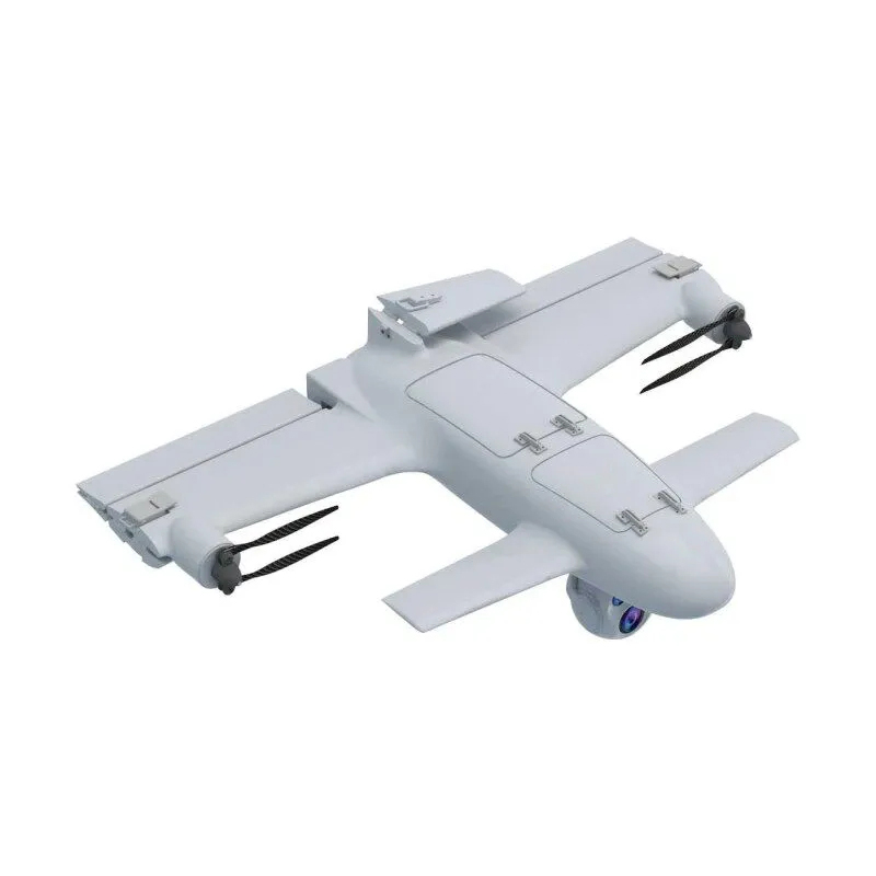 11th June 2026
How Are Drones Used for Border Security?
Border security has always depended on distance, timing, and visibility. A patrol team may need to watch long fence lines, mountain passes, river corridors, remote roads, or coastal approaches where fixed cameras and ground vehicles cannot cover every hour of the day. A surveillance UAV gives security teams a wider view without asking people to stand in exposed or hard-to-reach areas. The value is not that a drone replaces the full border security system. It is that a UAV can fill the space between towers, vehicles, ground sensors, and command posts. When it is planned well, it helps teams see more, document more, and send people only where they are actually needed. What does a border security UAV actually do? In a border mission, a UAV is mainly an aerial observation platform. It carries cameras, thermal sensors, mapping tools, communication links, or other approved payloads that help operators look at a large area from above. The aircraft may be a multirotor for short tasks, a fixed-wing drone for long routes, or a VTOL fixed-wing UAV when the site needs both runway-free launch and longer endurance. For buyers comparing platform categories, Skypath’s ISR Strike UAV page is a useful starting point because it shows how VTOL and fixed-wing configurations can support reconnaissance-style missions. Where are drones used along borders? Border areas are rarely simple straight lines. They often include open land, hills, forests, rivers, roads, inspection points, and critical infrastructure. UAVs are most useful when the team has a clear operating question instead of a vague desire to fly. Remote patrol support A UAV can scan a section before a patrol vehicle enters it. This helps the team check road conditions, weather exposure, damaged fencing, suspicious movement, or blocked access points. In rough terrain, that early look can save time and reduce unnecessary driving. Wide-area observation Fixed cameras are strong at watching one known point. A UAV is better at checking the space between points. A fixed-wing or VTOL aircraft can follow a corridor, circle a location for review, or compare current ground conditions with earlier imagery. Incident review and documentation After an alarm, a UAV can provide a visual record of the area. That record may help supervisors confirm whether the event was a person, vehicle, animal, weather damage, or a sensor false alarm. The benefit is practical: fewer blind decisions and clearer reporting. Infrastructure inspection Border security also includes gates, towers, roads, lighting, communication equipment, fences, and drainage. UAV imagery can help maintenance teams check where repairs are needed before sending crews to the field. Which UAV features matter most for border security? The best platform depends on geography and mission length. A small multirotor may be enough for a checkpoint. A long corridor usually needs a different aircraft. The table below turns the choice into practical buying questions. Feature Why it matters Typical buying question Endurance Longer flight time reduces launch cycles on long routes. How many minutes or hours are needed per patrol section? Payload options EO and thermal sensors support day and low-light observation. Which camera range and stabilization level are required? VTOL capability Runway-free launch helps in remote posts or tight sites. Is there enough flat space for conventional launch and recovery? Communication link Stable video and control links affect real-time decisions. What range and link resilience are needed for the area? Portability Single-team transport matters for mobile patrol units. Can the aircraft be moved, assembled, and recovered by the assigned team? Why do fixed-wing and VTOL drones fit long border routes? Long routes need coverage more than hovering. Fixed-wing drones are usually more efficient in forward flight, so they can cover wider areas with less battery drain. VTOL fixed-wing systems add another advantage: they can take off and land vertically, then fly like a fixed-wing aircraft once they reach altitude. Skypath’s Shadow Striker 2400 product page is a useful internal link for this topic because it presents a VTOL reconnaissance UAV designed around endurance, portability, and mission payloads. This combination is useful where a team cannot build a runway or where launch sites change from one shift to the next. It also helps when the route includes hills, rivers, or rough ground that would make vehicle patrol slow. How should a team plan UAV coverage? A UAV program works best when it is tied to specific zones and response rules. The aircraft should not fly randomly. Teams usually get better results by dividing the border area into repeatable sections, then matching each section with flight time, altitude rules, sensor settings, communication range, and reporting format. Map fixed cameras, towers, roads, and known blind areas before choosing flight routes. Separate routine patrol flights from alarm-response flights. Define what operators should record: location, time, imagery, and incident type. Plan battery charging, spare parts, weather limits, and maintenance windows. Keep flight permissions and local aviation rules visible in the operating plan. How do drones work with ground systems? A border UAV is only one part of a layered system. Radar, ground sensors, cameras, lighting, vehicles, command software, and human teams still matter. The UAV adds flexible eyes in the sky. It can check an alert, inspect a route, or provide a second angle when a fixed sensor cannot answer the full question. The strongest programs connect UAV data to normal reporting instead of leaving it as separate flight footage. If the operator sees damaged fencing, a blocked access road, or unusual movement, that information should move into the same workflow used by the command center and maintenance team. What limits should buyers remember? UAVs are useful, but they are not magic. Weather, airspace rules, battery life, communication range, pilot training, and sensor quality all shape the real result. A long-endurance aircraft can still be a poor choice if it is too hard to maintain. A strong camera can still disappoint if the data link is unstable. Buyers should also be careful with claims that sound too broad. A practical border security drone program starts with the route, environment, team size, and reporting needs. The platform should fit those needs instead of forcing the team to change everything around the aircraft. How does Skypath fit this use case? Skypath positions itself as a full-spectrum UAV solutions provider, with product lines covering unmanned aerial vehicles, reconnaissance platforms, anti-interference systems, and related payload technologies. Teams that are comparing aircraft categories can begin from the Skypath products page and then move into the UAV pages that match the route length and payload need. For border security planning, the most relevant discussion is not only the aircraft body. It is endurance, sensor fit, communication stability, launch method, maintenance support, and how quickly a team can turn imagery into useful field decisions. Conclusion Drones are used in border security to extend visibility, support patrol decisions, document incidents, and inspect remote infrastructure. The right UAV does not replace ground teams or fixed systems. It helps them work with better timing and clearer information. For long routes, fixed-wing and VTOL fixed-wing aircraft are often worth reviewing because they can combine coverage, endurance, and flexible launch options. FAQs Are drones useful for every border security site? No. They are most useful where distance, rough terrain, or blind areas make ground-only observation slow or incomplete. What is the main advantage of a surveillance UAV? A surveillance UAV gives teams a movable aerial view, which helps with patrol planning, alarm checks, and incident documentation. Why choose a VTOL fixed-wing UAV for border routes? VTOL launch helps at remote sites, while fixed-wing flight can cover longer corridors more efficiently than a hover-only platform. Should the UAV be linked with existing security systems? Yes. UAV footage and reports are more useful when they connect with ground sensors, command workflows, and maintenance records.
Learn More