Military ISR Drone Systems Modern Intelligence Operations for Mission Awareness
 author
 - 3rd July 2026
Modern intelligence is typically gathered in a timely, accurate and flexible manner to support defense, border security, crisis response, critical infrastructure protection and public safety missions. More than just a late report or a static observation post, timely information and aerial visibility, sensors, communications and data all play critical roles in making timely and informed decisions.Military ISR systems are typically integrated into an unmanned aerial vehicle or drone to collect visual information and to monitor a area of interest. This allows others to “look first” at a potential problem rather than sending a person into harm’s way first.
What Are Military ISR Drone Systems?
Military ISR drone systems are more than just aircraft or sensors mounted on aircraft to take pictures. They are integrated aerial information systems. They gather information, transmit information, organize information and support the review of the information gathered during a mission.
What Does ISR Mean in Modern Operations?
ISR stands for Intelligence, Surveillance, and Reconnaissance. The term Intelligence refers to the processing of gathered information to create usable knowledge. The term Surveillance refers to observation of a constant, or of repeated nature, such as of areas, routes, facilities, borders or of events. Reconnaissance refers to a more focused task, namely to gather information of a specific location, situation or operational question.
A major component of modern missions are the various functions of ISR, which very often are merged into a single platform. Thus a UAS can monitor a large area, record changes in that area, send live video to its operators, and then capture images which can be analyzed at a later time. The value of ISR is not just that one can see more, but rather that with this flow of current field information one can make better decisions than in the past.
How Do ISR Drones Fit Into the System?
ISR drones act as flexible aerial platforms. They can carry electro-optical cameras, infrared sensors, thermal imaging payloads, stabilized gimbals, mapping sensors, communication modules, and navigation systems. Compared with fixed cameras or ground patrols, drones can move quickly across different terrain and provide a wider field of view.
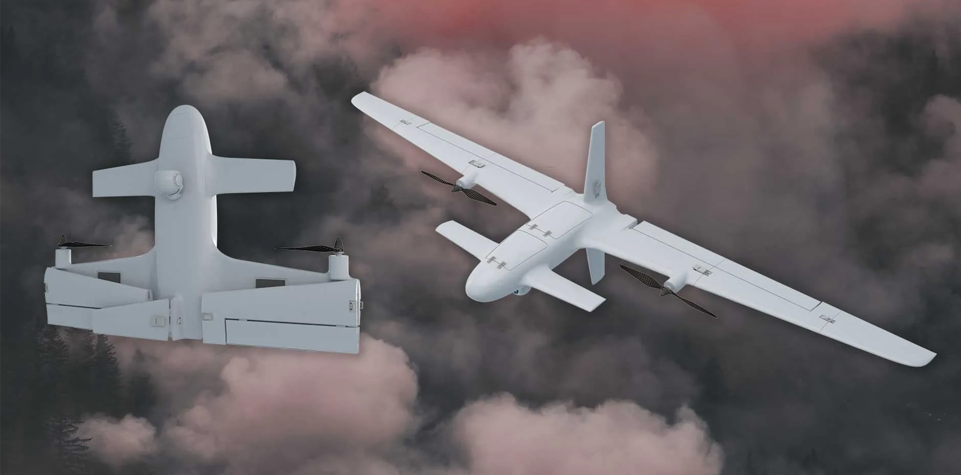
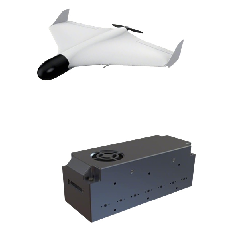
VTOL reconnaissance drones offer the combination of vertical take off and landing with the efficiency of a fixed wing aircraft for area reconnaissance. They are capable of taking off from small areas and can then be flown for long periods of time for surveillance of areas, monitoring of borders, inspection of infrastructure, for assessment of damage done during disasters as well as for security purposes.
Why Are ISR Systems More Than Just Drones?
A complete ISR drone system consists of the aircraft, payload, ground control station, communication link, navigation, data workflow, maintenance, and training of personnel. A strong airframe is the first and most important part of the solution.
For the professional buyer, what does the longest flight time mean? In the end, the drone must collect the data required by the buyer, it must maintain the correct positioning, transmit the data collected to the buyer in a format usable to him/her. Above all, it must function in an optimal manner to support the team’s true workflow/mission.
Why Are ISR Drones Important for Modern Intelligence Operations?
ISR equipped UAS’s provide vital information to teams without putting individuals in harm’s way. Additionally, the ability to conduct a field assessment in a timely manner is critical. Often teams are deployed to remote locations and are hindered by difficult terrain and adverse weather conditions that would put individuals at risk were they to conduct an assessment on foot.
How Do ISR Drones Improve Situational Awareness?
Situational awareness is defined as having knowledge of what is happening, where it is happening, and changes to the situation over time. ISR drones provide aerial views of borders, coastlines, roads, power lines, pipelines, ports, disaster scenarios, restricted sites and remote areas.
A border security organization with a long corridor between two fixed sensors would benefit from being able to check the corridor for persons or objects of interest. A disaster response organization would benefit from being able to assess a flooded road before dispatching vehicles. A security organization would benefit from having a greater field of view of a facility’s perimeter. An ISR drone provides a mobile aerial view or vantage point that fixed sensors are unable to provide.
Why Is Real-Time Data Important?
ISR information is often required in current form rather than in the form of outdated reports, such as: A route is blocked, a structure has been damaged or is changing quickly. ISR drones are able to send live video and images as well as location information and sensor data to the operators or the command team.
Real-time or near real-time data can help facilitate coordination with field teams, supervisors, first responders, and security teams. It can also help alleviate uncertainty prior to sending a team and associated resources to a site.
What Risks Can ISR Drones Help Reduce?
ISR drones can reduce direct personnel exposure in hazardous zones, rough terrain, unstable structures, and remote areas. They can also reduce unnecessary patrol time by helping teams check locations before sending people.
Drone data does not have to be interpreted by a drone. In fact, the greatest value of drones to human teams is better visibility, stronger documentation, and greater awareness of the field than would otherwise be possible.
What Technologies Matter in a Reliable ISR Drone System?
ISR Drone Systems require sensors, navigation, communication, autonomy and data processing to function reliably. The buyer should assess these criteria in conjunction with each other, rather than solely on one specification of the drone system.
What Sensor Payloads Are Commonly Used?
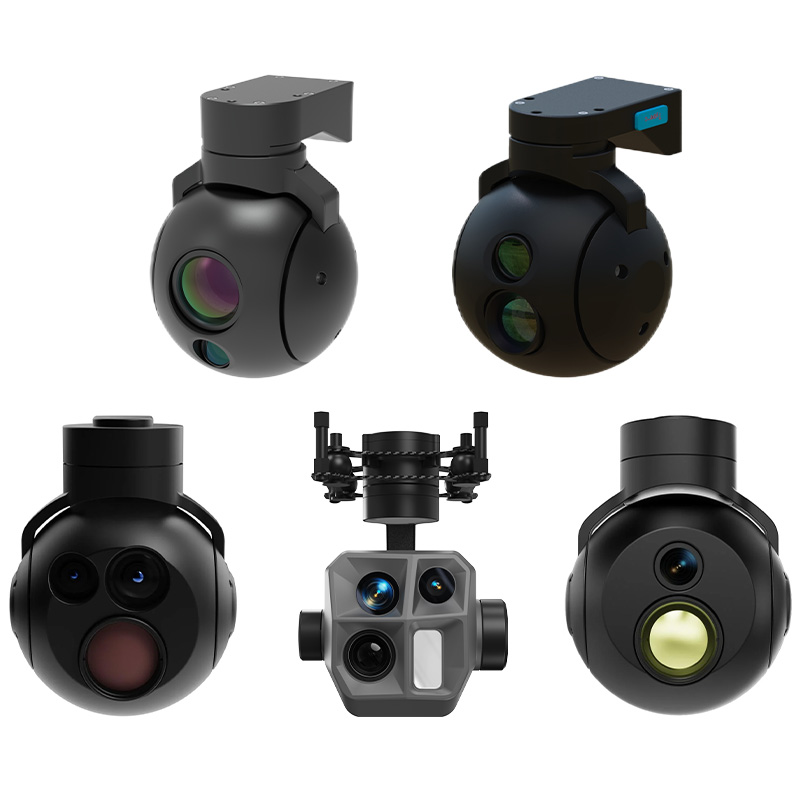
Common ISR payloads include EO cameras for daytime visual observation, IR or thermal sensors for low-light and heat-signature observation, laser rangefinder modules for distance measurement, and stabilized gimbals for smooth image capture.
A stabilized gimbal is especially important when the drone is moving, facing wind, or operating over uneven terrain. SKYPATH’s AD Series gimbal camera supports EO/IR/LRF payload configurations, image collection, manual capture, automatic tracking, and manual tracking. Its 2-axis high-stability platform is designed for applications such as inspection, security, search and rescue, firefighting, and law enforcement support.
Payloads are selected based upon the mission being conducted. For a mapping mission, it is usually best to shoot image with as much overlap as possible and try to maintain a constant route. For security, it is usually best to provide a stabilized video with low light capability and also provide thermal images when possible. For a rescue mission, it is typical to try to provide a wide search area as soon as possible, but then zoom in on points of interest to provide better detail for inspectors.
Why Do Navigation and Anti-Interference Features Matter?
ISR drones can be operated in complex environments where satellite signals are weak, are blocked or even are disturbed. Urban canyons, mountainous areas, dense forests, restricted sites and even electromagnetic interference can seriously affect the quality of the navigation system.
In order to provide reliable navigation, it can be a combination of satellite position determination, inertial navigation, vision-based navigation, altimeters, compasses and sensor fusion on board. SKYPATH’s Vision-Inertial Navigation Integrated Module consists of a vision-based navigation subsystem, IMU, satellite receiver, barometer, and compass. It is able to provide positioning, attitude, velocity, and altitude information in satellite denied environment.
For professional UAV operations, also anti-jamming technology is important. The SKYPATH AJ410 anti-jamming antenna for instance uses CRPA technology in combination with a digital antenna control unit. This setup enables a stable reception of GNSS signals even in jammed, contaminated radio-electric environments. For ISR missions in general the positioning stability is a critical safety aspect, allows for exact flight paths and for the collected data to have the highest possible value.
How Important Are Communication Links?
A drone that collects strong imagery but cannot transmit data reliably may not meet mission needs. Communication links affect command control, live video quality, data transfer, and operator confidence.
Professional ISR buyers need to look at how far the information can be transmitted, how stable the signal will be, what form of encryption is used, how resistant the signal is to interference, what type of antenna is used, and how it will be controlled from the ground. Some missions will only require information that has already been recorded on the aircraft, while others will require live information so that people can make decisions while the aircraft is still airborne.
Why Does Data Processing Matter?
ISR missions can generate a large amount of video, imagery, and mapping data as well as data from various sensors. If this data is not properly organized, it can overwhelm an operator.
AI-enabled perception, object recognition, automated alerts, and enhanced reporting workflows, organized into decision-enabling workflows, can aid in identification of important changes from vast amounts of video footage. The aim is not to gather hours of video. The aim is to gather valuable information and make timely decisions.
Why Choose Skypath as a Reliable ISR Drone Supplier?
Skypath is a professional UAV and counter-UAS system supplier serving government, defense, law enforcement, security, and emergency-related users. Its product categories include ISR UAV systems, VTOL reconnaissance drones, gimbal cameras, vision-inertial navigation modules, anti-jamming antennas, electronic warfare products, and counter-UAS solutions.
What Does Skypath Offer?
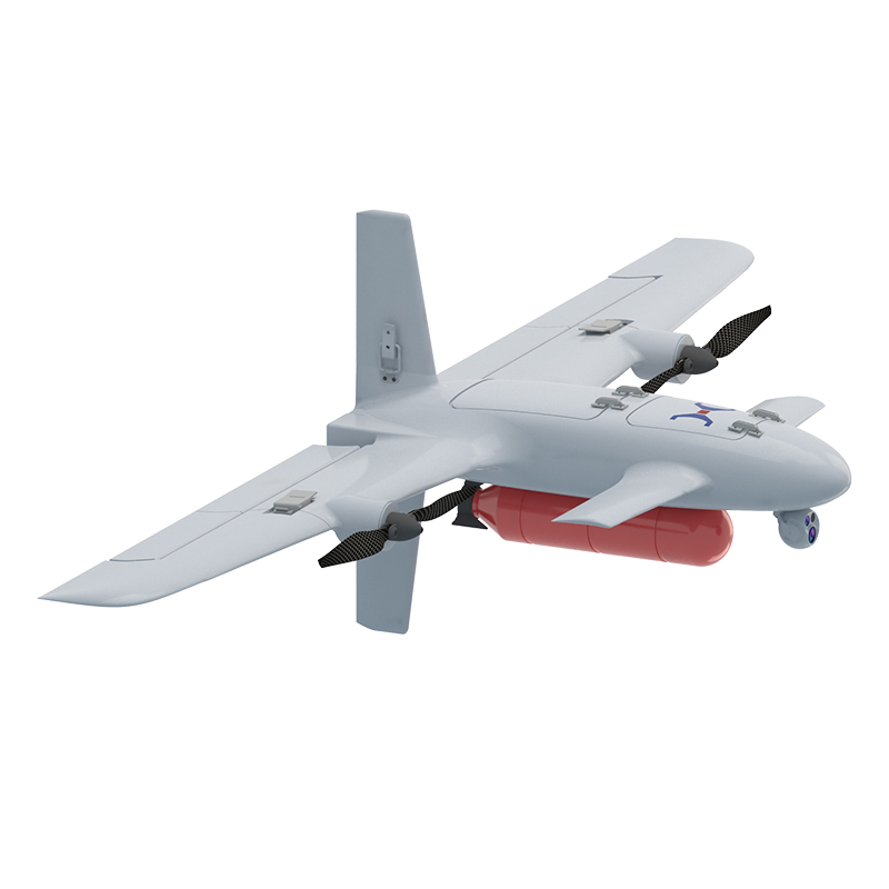
Skypath is a system level solution provider for the UAV eco-system, supporting the various components such as UAVs, payloads, navigation solutions, sensors with AI-perception, anti-jamming solutions and integration. Skypath’s ISR platforms are mainly VTOL type of UAVs that can take off and land without a runway, providing full autonomous operations, inter-changeable payload configurations and rapid deployment to areas that require intelligence and surveillance in minutes.
How Can Skypath Support ISR Drone Buyers?
Skypath assists buyers to select the correct UAV for their mission requirements, payload requirements, navigation requirements, communication requirements and environment requirements. Skypath can assist with technical discussions, selecting products, integration planning and testing as well as deploying the system and providing after sales service and spare parts planning.
For buyers looking for a reliable ISR drone supplier a system-orientated approach is far more important than choosing an airframe.
Conclusion
Military ISR drone systems today form the core of modern intelligence, gathering and processing information in a faster, safer manner and thereby granting mission participants a greater degree of awareness. A reliable ISR solution comprises more than just a flying camera. It also includes the aircraft, sensors, navigation, communication, data processing, training, maintenance and suppliers.
When an organization is considering ISR drone procurement, the best place to start is with the mission that the organization is trying to complete. By evaluating the operating environment, the route that will be flown, the type of payload that is required to gather the information needed to complete the mission, the communication range of the platform, the level of navigation risk associated with the flight, the degree to which the platform must comply with various regulations, and the type of support that the organization requires, buyers can determine which platform and supplier is best to support their objectives. With the right platform and the right supplier, an organization can allow its teams to see more, respond faster, and make better decisions with less risk.
FAQs
What is a military ISR drone system?
A military ISR drone system consists of a platform and sensors for intelligence, surveillance and reconnaissance as well as communication, navigation, ground control and data management, etc..
What sensors are useful for ISR drones?
Common ISR drone sensors include EO cameras, thermal or infrared cameras, stabilized gimbals, laser rangefinder modules, mapping sensors, and navigation modules. The best sensor package depends on the mission environment, visibility conditions, data needs, and operating range.
How should buyers choose an ISR drone supplier?
When purchasing a load handling system, the potential buyer must check a number of characteristics of the system, including the reliability of the platform, the possible payload, the resilience of the navigation system, the stability of the communication system, the system integration capabilities, the quality of the operator training, the maintenance service offered, the availability of spare parts, the documentation, and the support offered for compliance with laws and regulations.

Main Products
Our Main Products
At SkyPath we develop cutting-edge drones for every situation. Please browse our products.
Contact Us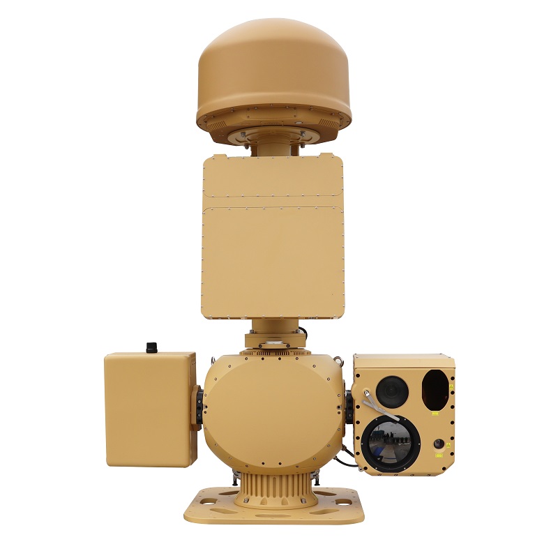
AUS70 Heavy-Duty Integrated C-UAS System
Anti-Drone Jammer Seeker

AD SERIES
Anti-jamming antenna AJ410
Anti-jamming antenna AJ440
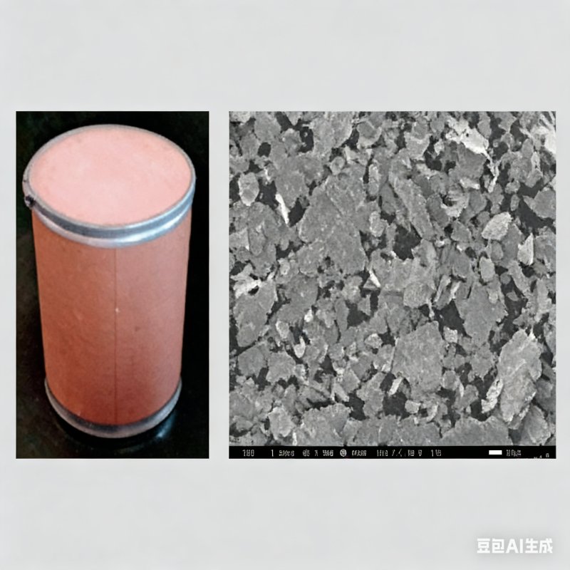
Radar Absorbing Agents